By using the Social Pinpoint Mapping Tool you agree to accept the Terms and Conditions set out below:
I agree to my comments being posted for the public to view through this platform.
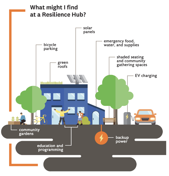
Resilience Hub Network
Welcome!
We’re excited that you’re here. The City of Austin is working with the Austin Independent School District, Travis County, and other community partners to pilot six resilience hubs (see map below) as part of a network that can help meet community needs before, during, and after extreme weather events and build community resilience day-to-day. Your stories will help us to identify places that can support resilience hubs and ensure that these spaces are designed and programmed to meet community needs. To learn more or participate in the activities below, close this window and click on the sidebar.
You can participate in two ways:
1. Take the Survey - What are your needs during a disaster event? How can we build community resilience day-to-day? Share your thoughts through this 10-15 minute survey.
2. Map Your Story - Use the interactive map to show places that are valuable to you, mark places that are vulnerable in your neighborhood, and provide feedback on potential resilience hub sites.
The first 20 submissions will receive a $15 gift card for participating!
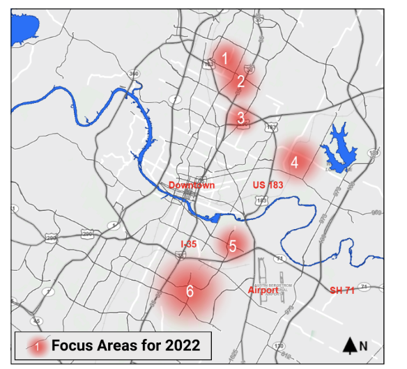
The six areas on the map are the Focus Areas for the Pilot Project, running in 2022. Below are the zip codes for each Focus Area. Future plans include building a larger network of hubs to serve the greater community.
- Focus Area 1 - 78758
- Focus Area 2 - 78753
- Focus Area 3 - 78752
- Focus Area 4 - 78724
- Focus Area 5 - 78741
- Focus Area 6 - 78744